Lesson:What is a site plan
1. Introduction
The purpose of the lesson: to learn what types of terrain images are, what is a terrain plan.
2. Types of images of the earth's surface
Before making a decision on the construction of new factories, schools, sports facilities, on laying roads, on the allocation of agricultural land, it is necessary to have an image of the area.
A small area can be drawn or photographed, but many objects on the earth's surface will be difficult to determine from such images.
The most common images of the earth's surface are aerial photographs, photographs from space, maps and plans of the area.
Rice. 1. Aerial photo
3. Aerial photographs and terrain plans: similarities and differences
Plan -a drawing of a reduced image of the area, made in conventional symbols on a large scale (usually 1: 5000 and larger). Usually plans are drawn up for a small area of land, several square kilometers in size, the curvature of the Earth's surface is not taken into account. The first maps in history were plans. Plans are used in a wide variety of industries and agriculture. When building buildings, laying roads and communications, you can’t do without them.
Objects placed on the surface (forests, rivers, villages, fields, etc.) will be seen better if the site is photographed from above, for example from an airplane. Such an image of the area is called an aerial photograph. On it, objects are similar to their true appearance on the ground, their size and relative position are visible. There are many differences between a plan and an aerial photograph. A local plan is a drawing on paper depicting a small area of the earth's surface in a reduced form. The plan differs from other images of the surface in that all objects on it are shown by conventional signs. In general, it is more convenient and informative to use the plan.
Aerial photograph and plan of the area:
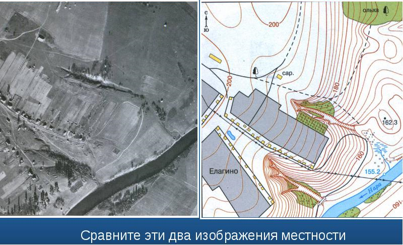
Rice. 2. Aerial photograph and plan of the area
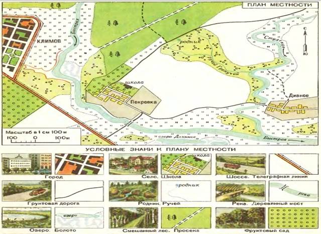
4. Plan of the area. Conventional signs
Directions on the plan are indicated by an arrow, the tip of which always points north. Usually the north on the plan is at the top, the south is at the bottom, the east is on the right, the west is on the left. According to the plan, you can determine the relative position of objects on the sides of the horizon, measure the distance between them using a single scale.
Rice. 3. Plan of the area
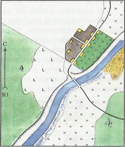
Rice. 4. Plan of the area and symbols for it
The conventional signs of the plan are, firstly, simple, secondly, dissimilar to each other, and thirdly, they resemble the objects themselves. Under such conditions, they are understandable to all who read the plan. Thus, rivers and lakes are shown in blue water, and forests in green - the color of vegetation. There is no special sign for fields, vegetable gardens, therefore, such areas are left white on the plan. The sign of the meadows resembles grass stalks. Sands are represented by brown dots. Small streams, roads, narrow streets are depicted with conventional signs in the form of lines. Such symbols are generally accepted. They are used on all terrain plans.
![]()
Rice. 5. Symbols
Symbol groups:
1. Areal