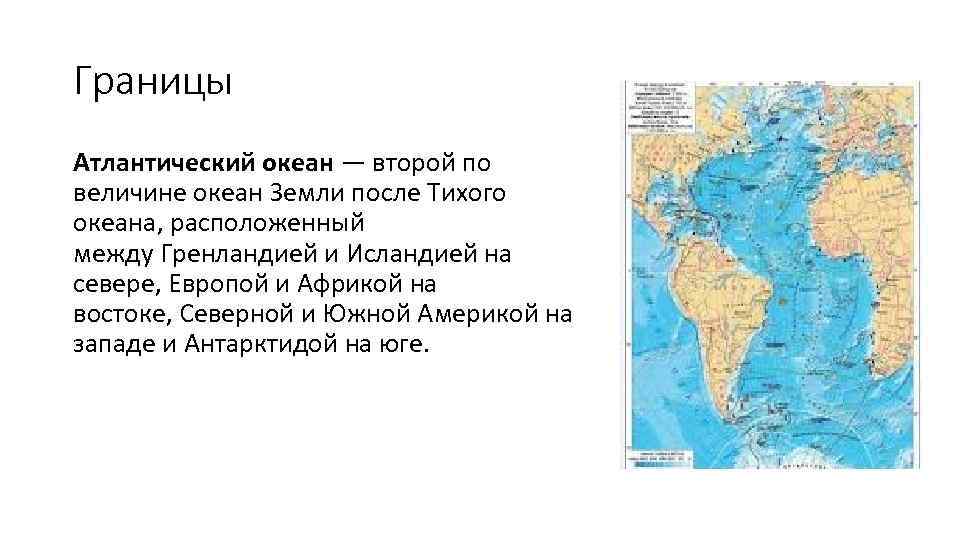
 Borders The Atlantic Ocean is the second largest ocean of the Earth after the Pacific Ocean, located between Greenland and Iceland in the north, Europe and Africa in the east, North and South America in the west and Antarctica in the south.
 The area is 91.6 million km², of which about a quarter is inland seas. The area of coastal seas is small and does not exceed 1% of the total water area.
 Seas and bays The most famous seas and main bays (clockwise): Irish Sea, North Sea, Bristol Bay, Norwegian Sea, Baltic Sea (Gulf of Bothnia, Gulf of Finland, Gulf of Riga), Bay of Biscay, Mediterranean Sea (Alboran Sea, Balearic sea, Ligurian Sea, Tyrrhenian Sea, Adriatic Sea, Ionian Sea, Aegean Sea), Sea of Marmara, Black Sea, Sea of Azov, Gulf of Guinea, Riiser-Larsen Sea, Lazarev Sea, Weddell Sea, Scotia Sea (the last four are sometimes referred to as the South Ocean), Caribbean Sea, Gulf of Mexico, Sargasso Sea, Gulf of Maine, Gulf of Saint Lawrence, Labrador Sea.
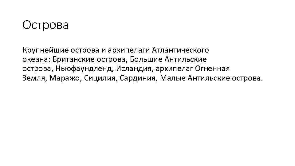 Islands The largest islands and archipelagos of the Atlantic Ocean: the British Isles, the Greater Antilles, Newfoundland, Iceland, the Tierra del Fuego archipelago, Marajo, Sicily, Sardinia, the Lesser Antilles.
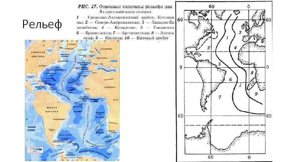
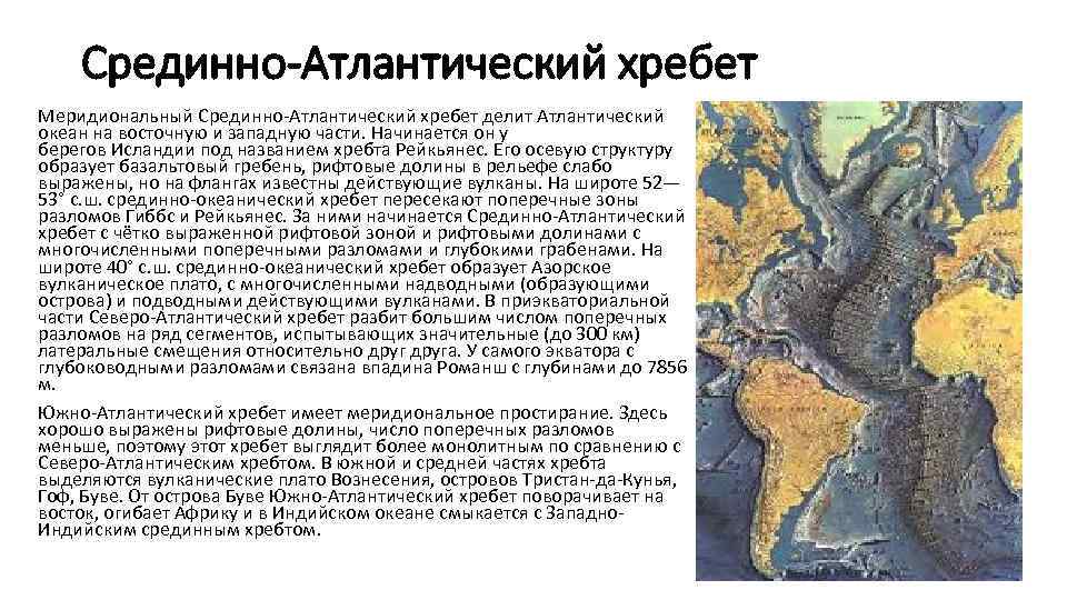 Mid-Atlantic Ridge The meridional Mid-Atlantic Ridge divides the Atlantic Ocean into eastern and western parts. It begins off the coast of Iceland under the name of the Reykjanes Range. Its axial structure is formed by a basalt ridge, rift valleys are poorly expressed in the relief, but active volcanoes are known on the flanks. At a latitude of 52-53 ° N. sh. the mid-ocean ridge is crossed by the transverse zones of the Gibbs and Reykjanes faults. Behind them begins the Mid-Atlantic Ridge with a clearly defined rift zone and rift valleys with numerous transverse faults and deep grabens. At a latitude of 40° N. sh. the mid-ocean ridge forms the Azores volcanic plateau, with numerous above-water (forming islands) and underwater active volcanoes. In the equatorial part, the North Atlantic Ridge is divided by a large number of transverse faults into a number of segments experiencing significant (up to 300 km) lateral displacements relative to each other. At the very equator, the Romansh depression is connected with deep-water faults with depths up to 7856 m. The South Atlantic Ridge has a meridional strike. Rift valleys are well expressed here, the number of transverse faults is less, so this ridge looks more monolithic compared to the North Atlantic Ridge. In the southern and middle parts of the ridge, the volcanic plateaus of the Ascension, the islands of Tristan da Cunha, Gough, and Bouvet stand out. From the island of Bouvet, the South Atlantic Ridge turns east, goes around Africa and merges with the West in the Indian Ocean. Indian median range.
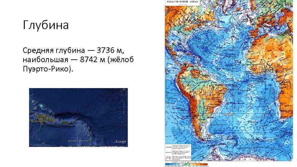
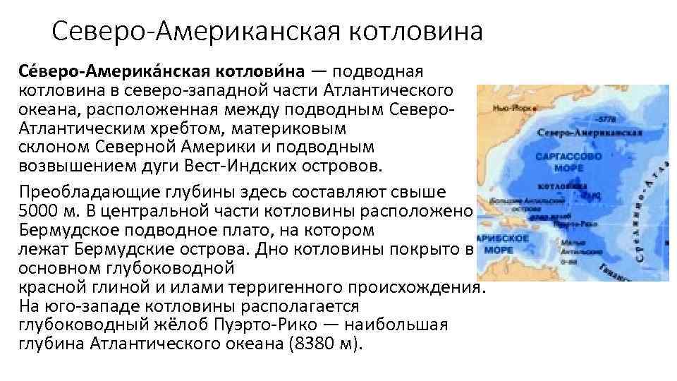 The North American Basin The North American Basin is an underwater basin in the northwestern part of the Atlantic Ocean, located between the underwater North. the Atlantic Ridge, the continental slope of North America and the underwater elevation of the arc of the West Indies. The prevailing depths here are over 5000 m. In the central part of the basin there is the Bermuda underwater plateau, on which the Bermuda Islands lie. The bottom of the basin is covered mainly with deep-water red clay and silts of terrigenous origin. In the southwest of the basin is the Puerto Rico deep-water trench - the greatest depth of the Atlantic Ocean (8380 m).
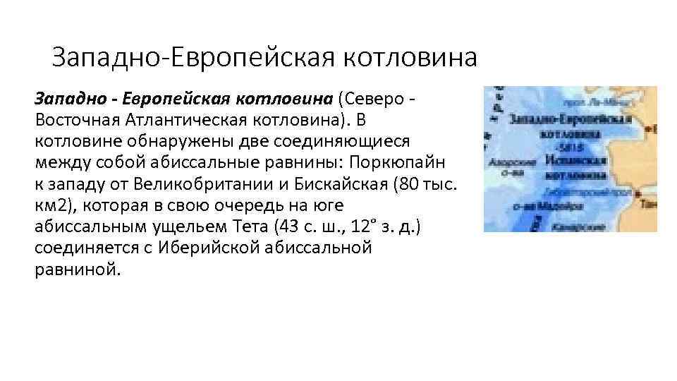 West European Basin West - European Basin (North - East Atlantic Basin). Two interconnected abyssal plains were found in the basin: Porcupine to the west of Great Britain and Biscay (80 thousand km 2), which in turn in the south is connected to Iberian abyssal plain.
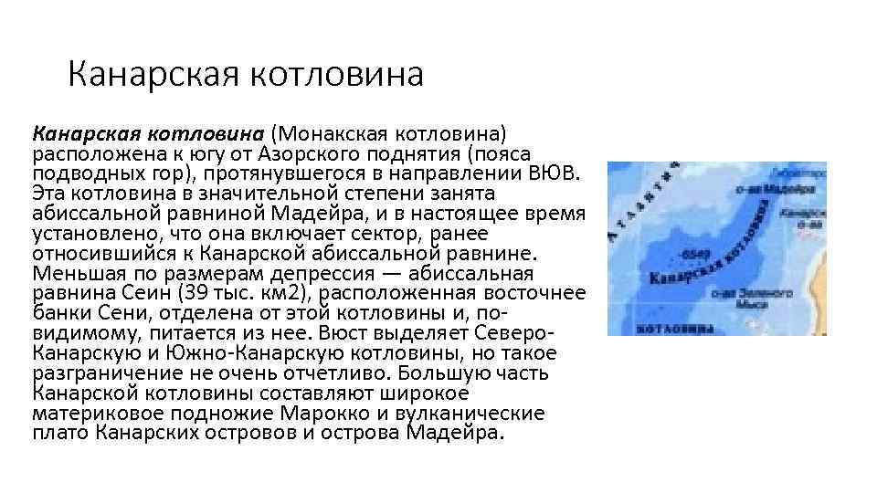 The Canary Basin (Monaco Basin) is located south of the Azores Rise (seamount belt), stretching in the direction of the ESE. This basin is largely occupied by the Madeira abyssal plain, and it is now established that it includes a sector formerly belonging to the Canarian abyssal plain. A smaller depression, the Sein abyssal plain (39,000 km2), located east of the Senya bank, is separated from this basin and, apparently, is fed from it. Wüst singles out the North. Canary and South Canary basins, but such a distinction is not very clear. Most of the Canary Basin is made up of the wide continental foot of Morocco and the volcanic plateaus of the Canary Islands and the island of Madeira.
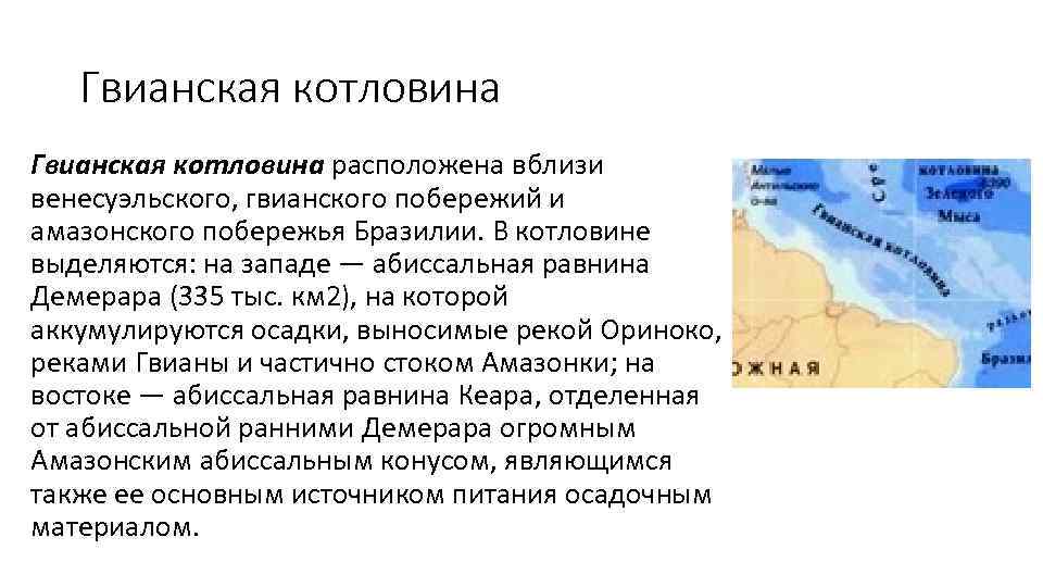 The Guiana Basin is located near the Venezuelan, Guiana coasts and the Amazonian coast of Brazil. In the basin, there are: in the west - the abyssal plain of Demerara (335 thousand km 2), on which sediments are accumulated carried out by the Orinoco River, the Guiana rivers and partly by the Amazon runoff; in the east - the abyssal plain of Keara, separated from the abyssal by the early Demerara by the huge Amazonian abyssal cone, which is also its main source of sedimentary material.
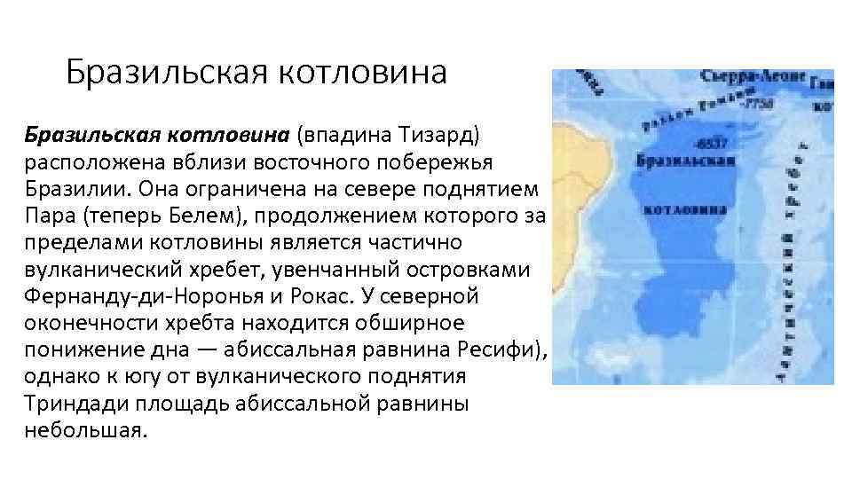 The Brazilian Basin (Tizard Basin) is located off the east coast of Brazil. It is bounded in the north by the Para (now Belem) uplift, which extends beyond the basin into a partly volcanic ridge topped by the islets of Fernando de Noronha and Rocas. At the northern end of the ridge there is a vast lowering of the bottom - the abyssal plain of Recife), however, south of the volcanic rise of Trindade, the area of the abyssal plain is small.
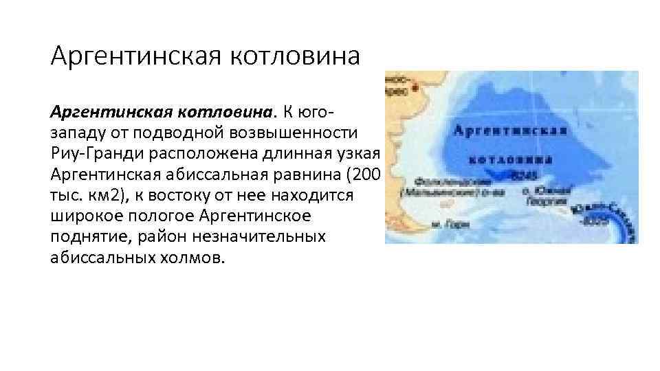 Argentine Basin. To the southwest of the Rio Grande underwater height there is a long narrow Argentine abyssal plain (200 thousand km 2), to the east of it there is a wide gently sloping Argentine uplift, an area of insignificant abyssal hills.
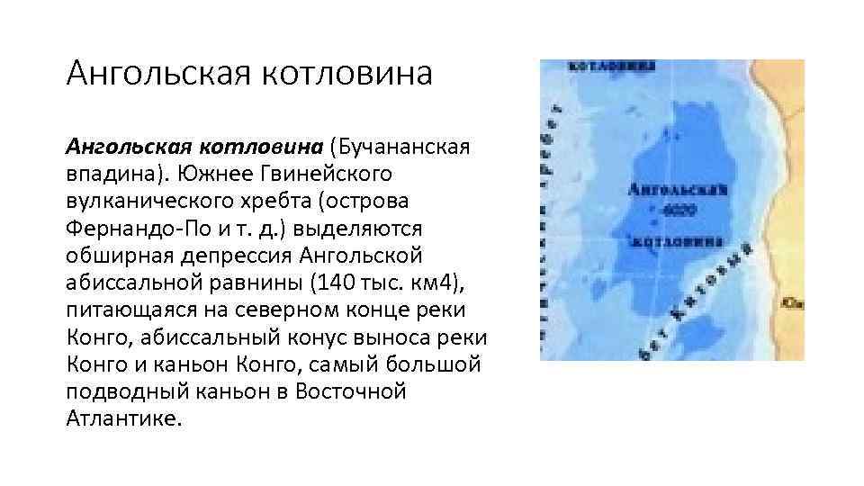 Angolan depression (Buchanan depression). South of the Guinean volcanic ridge (Fernando Po Islands, etc.), there is an extensive depression of the Angolan abyssal plain (140 thousand km 4), which feeds at the northern end of the Congo River, the abyssal fan of the Congo River and the Congo Canyon, the largest underwater canyon in Eastern Atlantic.
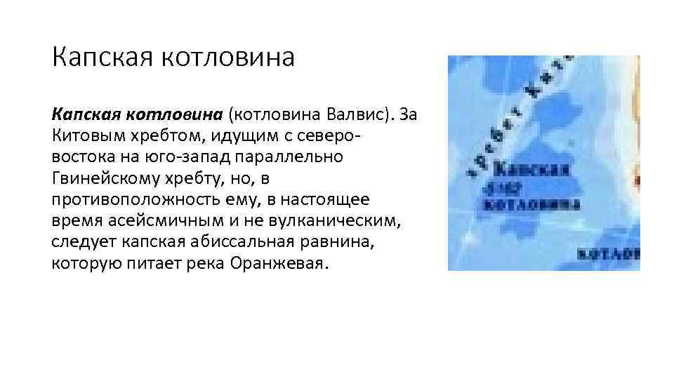 Cape Basin (Valvis Basin). The Whale Ridge, which runs northeast-southwest parallel to the Guinea Ridge but, in contrast, is currently aseismic and non-volcanic, is followed by the Cape Abyssal Plain, fed by the Orange River.
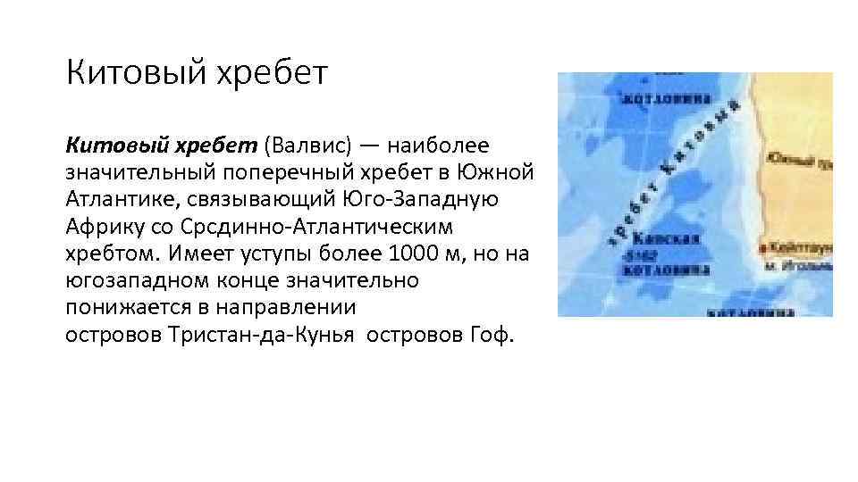 The Whale Ridge (Walvis) is the most significant transverse ridge in the South Atlantic, linking Southwest Africa with the Middle Atlantic Ridge. It has ledges of more than 1000 m, but at the southwestern end it drops significantly towards the Tristan da Cunha Islands of the Gough Islands.