Sea currents are classified:
According to the factors causing them, i.e.
1. By origin: wind, gradient, tidal.
2. By stability: constant, non-periodic, periodic.
3. By depth of location: surface, deep, bottom.
4. By the nature of movement: rectilinear, curvilinear.
5. By physical and chemical properties: warm, cold, salty, fresh.
By origin currents are:
1 Wind currents arise under the influence of friction on the water surface. After the wind begins to act, the current speed increases, and the direction, under the influence of Coriolis acceleration, deviates by a certain angle (to the right in the northern hemisphere, to the left in the southern hemisphere).
2. Gradient flows are also non-periodic and caused by a number of natural forces. They are:
3. waste, associated with surge and flow of water. An example of a drainage current is the Florida Current, which is the result of a surge of water into the Gulf of Mexico by the wind-driven Caribbean Current. Excess water from the bay rushes into the Atlantic Ocean, giving rise to a powerful current Gulf Stream.
4. stock currents arise as a result of the flow of river water into the sea. These are the Ob-Yenisei and Lena currents, penetrating hundreds of kilometers into the Arctic Ocean.
5. barogradient flows arising due to uneven changes atmospheric pressure over neighboring areas of the ocean and the associated increase or decrease in water level.
By sustainability currents are:
1. Permanent - the vector sum of wind and gradient currents is drift current. Examples of drift currents are the trade winds in the Atlantic and Pacific oceans and the monsoon currents in the Indian Ocean. These currents are constant.
1.1. Powerful stable currents with speeds of 2-5 knots. These currents include the Gulf Stream, Kuroshio, Brazilian and Caribbean.
1.2. Constant currents with speeds of 1.2-2.9 knots. These are the Northern and Southern trade wind currents and the equatorial countercurrent.
1.3. Weak constant currents with speeds of 0.5-0.8 knots. These include the Labrador, North Atlantic, Canary, Kamchatka and California currents.
1.4. Local currents with speeds of 0.3-0.5 knots. Such currents are for certain areas of the oceans in which there are no clearly defined currents.
2. Periodic flows- these are currents whose direction and speed change at regular intervals and in a certain sequence. An example of such currents is tidal currents.
3. Non-periodic flows are caused by non-periodic influence of external forces and primarily by the influences of wind and pressure gradient discussed above.
By depth currents are:
Superficial - currents are observed in the so-called navigation layer (0-15 m), i.e. layer corresponding to the draft of surface vessels.
The main reason for the occurrence superficial currents in open ocean is the wind. There is a close relationship between the direction and speed of currents and prevailing winds. Steady and continuous winds have a greater influence on the formation of currents than winds of variable directions or local ones.
Deep Currents observed at a depth between the surface and bottom currents.
Bottom currents take place in the layer adjacent to the bottom, where big influence they are subject to friction from the bottom.
The speed of surface currents is highest in the uppermost layer. It goes deeper. Deep waters move much slower, and the speed of movement of bottom waters is 3 – 5 cm/s. Current speeds are not the same in different areas of the ocean.
According to the nature of the current movement, there are:
According to the nature of the movement, meandering, rectilinear, cyclonic and anticyclonic currents are distinguished. Meandering currents are those that do not move in a straight line, but form horizontal wave-like bends - meanders. Due to the instability of the flow, meanders can separate from the flow and form independently existing vortices. Straight currents characterized by the movement of water in relatively straight lines. Circular flows form closed circles. If the movement in them is directed counterclockwise, then these are cyclonic currents, and if they move clockwise, then they are anticyclonic (for the northern hemisphere).
By the nature of physical and chemical properties they distinguish between warm, cold, neutral, salty and desalinated currents (the division of currents according to these properties is to a certain extent arbitrary). To assess the specified characteristics of the current, its temperature (salinity) is compared with the temperature (salinity) of the surrounding waters. So, warm (cold) is a current whose water temperature is higher (lower) than the temperature of the surrounding waters.
Warm currents whose temperature is higher than the temperature of the surrounding waters are called; if it is lower than the current they are called cold. Salty and desalinated currents are determined in the same way.
Warm and cold currents . These currents can be divided into two classes. The first class includes currents whose water temperature corresponds to the temperature of the surrounding water masses. Examples of such currents are the warm Northern and Southern Trade Winds and the cold Western Winds. The second class includes currents whose water temperature differs from the temperature of the surrounding water masses. Examples of currents of this class are the warm Gulf Stream and Kuroshio currents, which carry warm waters to higher latitudes, as well as the cold East Greenland and Labrador currents, carrying cold waters of the Arctic basin to lower latitudes.
Cold currents belonging to the second class, depending on the origin of the cold waters they carry, can be divided into currents that carry cold waters from the polar regions to lower latitudes, such as the East Greenland and Labrador. the Falkland and Kuril currents, and currents of lower latitudes, such as the Peruvian and Canary (the low temperature of the waters of these currents is caused by the rise of cold deep waters to the surface; but the deep waters are not as cold as the waters of currents coming from higher to lower latitudes).
Warm currents, transporting warm water masses to higher latitudes, act on the western side of the main closed circulations in both hemispheres, while cold currents act on their eastern side.
There is no upwelling of deep waters on the eastern side of the South Indian Ocean. Currents on the western side of the oceans, compared to surrounding waters at the same latitudes, are relatively warmer in winter than in summer. Cold currents coming from higher latitudes are of particular importance for navigation, as they transport ice to lower latitudes and cause greater frequency of fog and poor visibility in some areas.
In the World Ocean by character and speed The following groups of currents can be distinguished. The main characteristics of the sea current: speed and direction. The latter is determined in the opposite way compared to the method of wind direction, i.e. in the case of a current it is indicated where the water flows, whereas in the case of wind it is indicated from where it blows. Vertical movements of water masses are usually not taken into account when studying sea currents, since they are not large.
There is not a single area in the World Ocean where the speed of currents does not reach 1 knot. At a speed of 2–3 knots, mainly trade wind currents and warm currents flow along the eastern coasts of the continents. The Intertrade Countercurrent, currents in the northern part of the Indian Ocean, in the East China and South China Seas, moves at this speed.
§ 43. Currents
"Rivers" in the seas and oceans. Currents are types of water movements in the World Ocean. These are horizontal movements of water in the form of wide streams. Although ocean currents do not have banks, they are often compared to rivers.
The main reason for their formation is constant winds. The current itself is called that - current of the Western Winds. It forms a circle 30 thousand km long around Antarctica. The width of the current is several kilometers, the speed is 3 km/h. Compare with the largest river in Ukraine - the Dnieper, total length which is only 2,201 km, and the width in Kyiv is 400-600 m.
Warm and cold currents. The temperature of the current is considered relative to the surrounding waters. Warm current has a water temperature several degrees higher than the surrounding ocean water. Cold current- Vice versa. Warm currents are usually directed from warmer latitudes to colder ones, and cold currents - vice versa. You already know that currents significantly influence the climate of the coasts. Thus, warm currents increase the air temperature by 3-5 0 C and increase the amount of precipitation. Cold currents lower temperatures and reduce precipitation. On geographic maps, warm currents are shown with red arrows, cold currents with blue arrows.
The largest warm current - Gulf Stream. She goes to Atlantic Ocean and heads from the eastern shores North America to Europe. Its length is 3 thousand km, its width is over 100 km, its current speed is up to 10 km/h. This current warms the coasts of the Scandinavian Peninsula, which without it would turn into an icy desert. It is no coincidence that warm currents are called “water heating” of the globe. Air masses forming over the warm Gulf Stream heat up, become saturated with moisture and bring heavy precipitation to Europe. Around 45 0 mon. w. The Gulf Stream moves into North Atlantic current, Under the influence of which the Barents Sea does not freeze. IN Pacific Ocean off the coast South America the cold passes Peruvian Current. The air masses that form over its cold waters are not saturated with moisture and do not bring precipitation to the land. As a result, there is no precipitation on the coast for several years, which led to the occurrence of Atacama Desert.

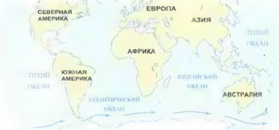
Rice. Warm and cold currents on geographic maps
Patterns of current movement . Since the main reason for the formation of currents on the surface of the water is constant winds, their movement in the World Ocean approximately corresponds to the movement of air masses. However, their movement is also influenced by the deflecting force of the Earth's rotation around its axis and the outlines of the continents. Thus, constant trade winds blowing in both hemispheres from latitudes 30 to the equator form powerful Northern Trade windsі Southern Trade Wind Currents. These currents cross the Ocean from east to west. Having encountered the shores of the continents, the currents bifurcate and deviate to the south and north. At the same time, new currents are formed and directed back - from west to east. Their direction in temperate latitudes is influenced by constant westerly winds and the deflecting force of the Earth's rotation. So in both hemispheres in the Ocean there are two gyres . In the Northern Hemisphere, currents form a vicious circle and move clockwise, in the Southern Hemisphere - counterclockwise.
Ocean currents play a huge role in the distribution of heat across the globe. They carry not only heat, but also salts and organisms that live in the ocean.
Water masses.Large volumes of water that form in certain areas of the World Ocean and differ from each other in temperature, salinity, transparency, oxygen content and other properties are called water masses. Depending on geographic latitude, water masses are distinguished equatorial, tropical, temperate, polar . They actively interact with the atmosphere: they give off heat to it, absorb heat from it carbon dioxide, release oxygen.
Question and task
1. How do currents differ from the movement of water during waves?
2. Describe on a map the route of a bottle with a message that was thrown from a boat in the Drake Passage.
3. Which statement is more accurate and correct: “The wind is what moves the waters in the Ocean” or “The Sun is what moves the waters in the Ocean”?
4. Explain why the Peruvian Current with a water temperature of 22 0 C is called cold, and the North Atlantic Current with a water temperature of 2 0 C is called warm.
5. Why is the Gulf Stream called the “warmer” of Europe?
6. Nature o. Spitsbergen is somewhat different from the nature of other Arctic islands. It’s warmer there, there’s more snowfall, and there’s vegetation. What explains this?
7. The famous Norwegian traveler Thor Heyerdahl sailed on the papyrus raft "Kon-Tiki" from the coast of South America (12 0 S, 77 0 W) to the Tuamotu Islands (21 0 S, 135 0 zx.d.). Trace his voyage route on the map. What determined this movement of the raft?
“There is a river in the ocean. It does not dry out even during the most severe droughts and does not overflow its banks during the largest floods. Its banks and bed are made of cold water, and its rapids are made of warm water.”. So in mid-19th V. American scientist M. F. Mori wrote about the world’s most powerful warm ocean current Gulf Stream .
Ocean currents - horizontal movements of huge masses of water in a certain direction over long distances.
More often ocean currents arise under the influence of constant winds. Such currents are called winds. On both sides of the equator from the 30th latitude, constant trade winds blow in its direction, arising in the equatorial zone of all oceans. The currents caused by these winds are called trade winds(Fig. 80). Moving from east to west, trade wind currents, encountering the shores of continents, deviate to the north and south, and new currents are formed, called stock.
In temperate latitudes, these currents, under the influence of constant westerly winds and the force of the Earth's rotation, deviate to the east and are directed to the western shores of the continents. Then they return to 30 latitudes again as katabatic currents. So, north and south of the equator in zones 50 s. w. and 50° S. w. Two cycles of ocean water arise. In the Northern Hemisphere, currents move clockwise, in the Southern Hemisphere - vice versa. In the Northern Hemisphere, along the coast of Antarctica, under the influence of constant winds of moderate latitudes and the force of the Earth’s rotation, a powerful current of the Western Winds(Fig. 82). The name itself speaks about the reasons for its formation.
Distinguish warm And cold currents. If the temperature of the current water is higher than the temperature of the surrounding ocean waters, then it is considered warm, if below - cold. On maps, warm currents are indicated by red arrows, cold currents by blue arrows. Currents in the oceans significantly influence the climate and weather of the coastal parts of the continents. Cold ones reduce the temperature and amount of precipitation, while warm ones, on the contrary, increase it.
In shipping, it is important to take into account the strength and direction of currents. In the past they were used as "bottle mail". Material from the site
 |
| Rice. 82. Current of the Western Winds |
- Sea currents arise mainly under the influence of constant winds: trade winds and western temperate latitudes. They form two gyres in the World Ocean between 50 latitudes: in the Northern Hemisphere, the currents move clockwise, and in the Southern Hemisphere, vice versa.
- Currents are divided into cold and warm. On maps, warm currents are indicated by red arrows, cold currents by blue arrows.
- Currents influence the climate and weather of the coastal parts of the continents.
On this page there is material on the following topics:
Warm and cold currents of the world on the map
World map with currents warm red cold blue
Warm and cold currents on the map of the world's oceans
Ocean currents report
Physical map of the eastern hemisphere with cold and warm currents
Questions about this material: